Summary
Created to defend the port of Havre de Grace (later known as Le Havre) the citadel was described in1835 as:
“Havre de Grace is one of the strongest towns in Europe, with an excellent port for men of war, which ride in great safety: It is situated at the mouth of the Seine, in the county of Caen in Normandy, it is well fortified, and has a fine citadel, with a large arsenal for naval stores. High water at nine.”
The citadel was demolished in 1865 to extend the port and to create the Bassin de la Citadelle.
The citadel can clearly be seen on the map shown on this page, as a star shaped fortification.
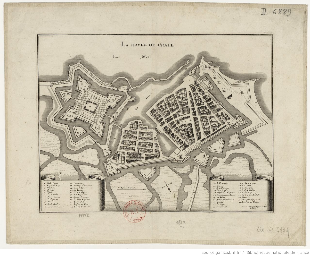
“La (sic) Havre de Grâce” by Jaques Gomboust, 1657. Source: BnF
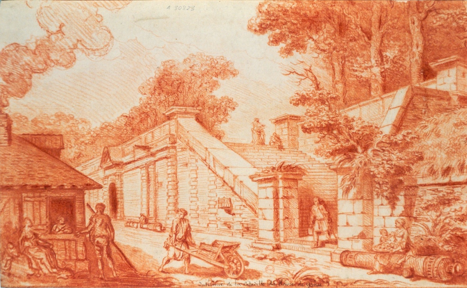
“Intérieur de la citadelle du Havre de Grâce” by Hubert Robert. 1700. Source: BnF. Shows woman sitting on cannon – one of many bearing the King’s motto.
Map
[google-map-v3 shortcodeid=”98e5c557f9″ width=”95%” height=”350″ zoom=”12″ maptype=”roadmap” mapalign=”center” directionhint=”false” language=”default” poweredby=”false” maptypecontrol=”true” pancontrol=”true” zoomcontrol=”true” scalecontrol=”true” streetviewcontrol=”true” scrollwheelcontrol=”false” draggable=”true” tiltfourtyfive=”false” enablegeolocationmarker=”false” enablemarkerclustering=”false” addmarkermashup=”false” addmarkermashupbubble=”false” addmarkerlist=”Bassin de la Citadelle, 76600, Le Havre, France{}1-default.png{}Citadel of Havre de Grace (Le Havre), France” bubbleautopan=”true” distanceunits=”miles” showbike=”false” showtraffic=”false” showpanoramio=”false”]
Referring entries
Further reading
- None
Sources
- The Gentleman’s Magazine, Volume 28.
Recent Comments