Summary
A castle in Dieppe . The castle was built in 1188, destroyed in 1195 and restored in the 14th century.
The castle is composed of a quadrangular enclosure with round flanking towers and a lower court adjacent.
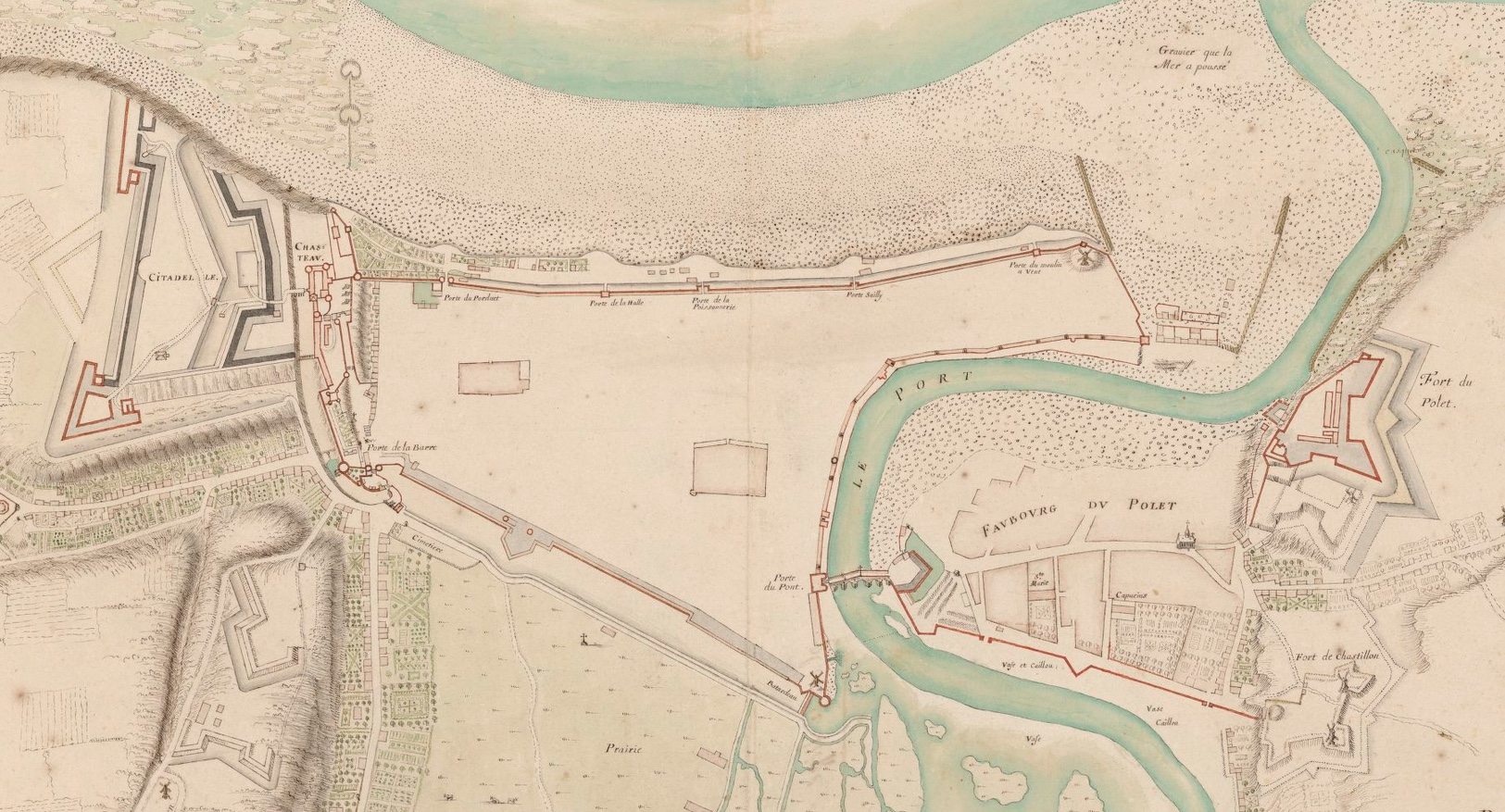
Detail from “Plan de Dieppe” showing citadel to left and Fort du Pollet to the right of map. Source:BNF.
Map
[google-map-v3 shortcodeid=”39baa9e2ea” width=”95%” height=”350″ zoom=”12″ maptype=”roadmap” mapalign=”center” directionhint=”false” language=”default” poweredby=”false” maptypecontrol=”true” pancontrol=”true” zoomcontrol=”true” scalecontrol=”true” streetviewcontrol=”true” scrollwheelcontrol=”false” draggable=”true” tiltfourtyfive=”false” enablegeolocationmarker=”false” enablemarkerclustering=”false” addmarkermashup=”false” addmarkermashupbubble=”false” addmarkerlist=”Château de Dieppe, France{}1-default.png{}Château de Dieppe, France” bubbleautopan=”true” distanceunits=”miles” showbike=”false” showtraffic=”false” showpanoramio=”false”]
Referring entries
Further reading
Sources
- Bibliothèque nationale de France for image.
Recent Comments